ANNAPURNA CIRCUIT TREK [5416 meters]
>1(Min) -12(Max)
5416m
mar-may
Overview
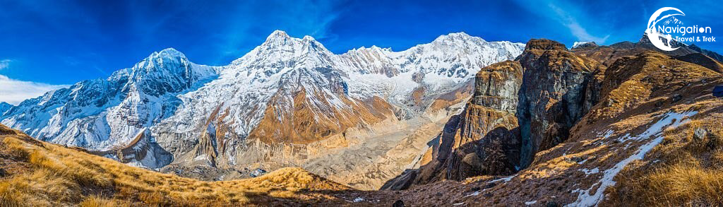
Annapurna Circuit Trek has been one of the most challenging and exhilarating long-distance trekking routes in the world as it attracts thousands of trekking enthusiasts every year. This journey, which spans a distance of between 160 and 230 kilometers (100-145 miles), is renowned for its breathtaking views of the Annapurna Massif, dramatic deep canyons, wild animals, hot springs, desolate high snow-capped peaks, viewpoint, monasteries, and panoramic farming communities. This circuit takes you through the breathtaking Marshyangdi and Kali Gandaki River basins as well as the Thorong-La pass (5416m/17769 ft), which is located on the border with Tibet, at an elevation of more than 5000 meters. This beautiful yet challenging trek is a great way to immerse yourself completely in the spectacular mountain wilderness as well as inspire those with a bold spirit and a yearning for a definitive nature experience with some unforgettable journey in the Himalayas.
Itinerary
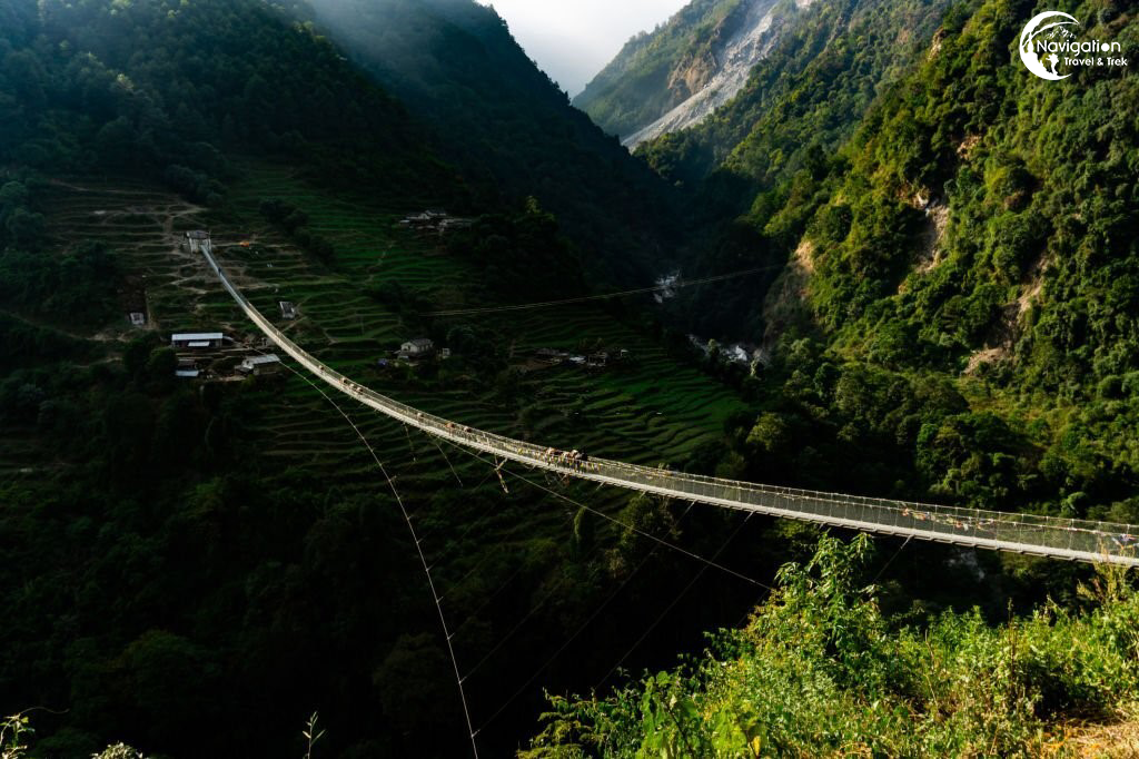
The journey starts with a 4-5 hours bus or jeep ride from Pokhara to Besisahar, the Capital center of the Lamjung District and the beginning point of the hike. After arriving at Besisahar, we continue on the trail to Pam Khola and ascend into the town of Denauti, where we will get a close-up look at Nepalese rural life. We arrive at the Gurung settlement of Bhulbhule, which is roughly three hours away from Besisahar, as the route approaches the Khudi Khola.
You will observe the Marshyangdi river and endless green views of the indigenous way of life along your journey. For trek access at Bhulbhule, you must register your permits at the checkpoint.
Bhulbhule
Lodge
Breakfast, Lunch, Dinner
1300m
5hr
After a nutritious breakfast, we set out on our second day of hiking. The path continues via woodlands, rice terraces, and several suspension bridges as it follows the Marshyangdi River. Before arriving at the community of Hani Gaon, it then climbs once more and makes its way around the mountainside before reaching Syange. From Syange, the trail begins on a tough incline and sheer cliff-face rock about 200-300m above the riverbed. We can see the Marshyangdi Khola below and the rocky hills all around once we get to the tranquil settlement of Jagat, a former trading post.
- Hiking time: 5-6 hours
- Descent: 16 km/9.9 miles
- altitude: 1300 m
- Accommodation: Teahouse/Lodge
- Meals included: Breakfast, Lunch and Dinner
Jagat
Lodge
Breakfast, Lunch, Dinner
1300m
6hr
We begin our third day of trek from Jagat following the Marshyangdi river, continue through a beautiful forest and finally climb to a rock face with a jagged edge until we arrive at Tal village, which is located close to the Manang area. The terrain becomes more difficult and winding as we walk away from Tal, passing the dense communities of Karte and Kodo, one of the biggest settlements in the Manang valley. Several waterfalls, stunning hillside steps, and the wooded Gurung Community with its unique culture can all be seen throughout the route. Throughout the trial, we can observe several waterfalls, beautiful hilly steeps as well as forested Gurung Community and its rich culture. Moving on we cross a suspension bridge to reach Dharapani, our destination for the day.
- Hiking time: 5-6 hours
- Trek Distance: 15km / 9.3miles
- altitude: 1,860m / 6,200ft
- Accommodation: Teahouse/Lodge
- Meals included: Breakfast, Lunch and Dinner
Dharapani
Lodge
Breakfast, Lunch, Dinner
1860m
6hr
After leaving Dharapani, we travel down the Marshyangdi River’s pathways through the trees till we arrive at Bagarchap, a Bhotia village with vibrant prayer flags. Until we reach Kotho, where we may have an excellent glimpse of Annapurna II, we continue climbing through forests of pine, fir, oak, maple, and rhododendron trees as well as steep incline slopes. The trail arrives in Chame, the administrative center for the Manang district, which is marked by a big white gate with a corrugated iron roof. One of the major attractions of the captivating village of Chame is the natural hot spring where we can relax and enjoy the scenery. Green forest will surround you, and when you glance up, Lamjung Himal, Annapurna II, and Annapurna IV (7,525m) will be seen in stunning detail.
- Hiking time: 6-7 hours
- Trek Distance: 15.5km / 9.6miles
- altitude: 2,610m / 8,890ft
- Accommodation: Teahouse/Lodge
Meals included: Breakfast, Lunch and Dinner
Lodge
Breakfast, Lunch, Dinner
2610m
7hr
After a relaxing break in Chame, we leave towards Pisang through steep trails on the southern side. At 3040 meters, we cross a lengthy suspension bridge and get our first glimpse of the Paungda Danda Rock, a gigantic rock face that rises more than 1500 meters above the river. The locals respect it much and see it as sacred. We can see Pisang Peak in the northeast and Annapurna II in the south from the routes. We cross one more bridge to reach Pisang town at the bottom of the Manang Valley, where we will spend the night.
- Hiking time: 5-6 hours
- Trek Distance: 13.2km / 8.2miles
- altitude: 3,115m/10,200ft
- Accommodation: Teahouse/Lodge
- Meals included: Breakfast, Lunch and Dinner
Pisang town
Lodge
Breakfast, Lunch, Dinner
3115m
6hr
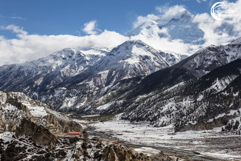
Today, we heading on the upper routes through upper Pisang, from which we can enjoy stunning views of the Manang valley as well as the north face Annapurna range, which includes Annapurna II, Annapurna III, Annapurna IV, Gangapurna (7455m) and Tilicho Peak (7134m). We descend through Manang’s airstrip to reach Hongde, which connects to the broad plain of the Sabje Khola Valley. After a short distance, we approached the settlement of Mungji after crossing a wooden bridge. The trail goes through the Tibetan settlements until we arrive at the village of Braga, where we get a chance to explore Buddhist culture. We will get to visit Barge Monastery, the largest monastery in Manang where the trail is lined with Buddhist shrines. When we reach our current destination of Manang, we will end our walk.
- Hiking time: 5-6 hours
- Trek Distance: 17km / 10.6miles
- altitude: 3,540m / 11,300ft
- Accommodation: Teahouse/Lodge
Meals included: Breakfast, Lunch and Dinner
Lodge
Breakfast, Lunch, Dinner
3539m
6hr
On this day, we will be acclimatizing. However, we will be exploring Manang village all day long. To see Gangapurna & Ice Lakes, we will trek another 300 meters. The remainder of the day will be spent admiring the stunning views of Annapurna III, Tilicho, Pisang and Chulu Peaks.
- altitude: 3,800 m
- Accommodation: Teahouse/Lodge
Meals included: Breakfast, Lunch and Dinner
Lodge
Breakfast, Lunch, Dinner
3800m
1hr
We will go to our next destination, Yak Kharka, after acclimating to the high elevation and giving our bodies time to relax and adjust to the surroundings in Manang. Before reaching Tenki village, 120 meters above Manang, we must first cross many streams and climb. Then we continue climbing past Marshyangdi Valley in the northwest direction of Jar Sang Khola valley.
We will be passing through scrub juniper and alpine grasses, marking the difference in altitude, as we approach the little settlement of Gunsang (3960 meters), where the residences are built of flat mud roofs. After traveling only, a short distance, we ascend the breathtaking valley to Yak Kharka, an open, peaceful grassland.
- Hiking time: 3-4 hours
- Trek Distance: 9.4km / 5.8miles
- altitude: 4,050m / 14,275ft
- Accommodation: Teahouse/Lodge
- Meals included: Breakfast, Lunch and Dinner
Yak Kharka
Lodge
Breakfast, Lunch, Dinner
4050m
4hr
Leaving Yak Kharka, we head to the foot of Thorong La pass, Thorong Phedi, the highest point on the Annapurna Circuit. From Yak Kharka, we climb gradually to a ridge before descending to the headwaters of the Marshyangdi and crossing via a covered wooden bridge. After climbing up the mountain, we follow a narrow trail across an unstable steep slope until we reach Thorong Phedi.
- Hiking time: 4-5 hours
- Trek Distance: 8.5km / 5.2miles
- altitude: 4,525m / 14,525ft
- Accommodation: Teahouse/Lodge
Meals included: Breakfast, Lunch and Dinner
Thorong Phedi
Lodge
Breakfast, Lunch, Dinner
4524m
5hr
The climb from Thorong Phedi (4,525m/14,525ft) to Mukti Nath Temple (3,760m/12,623ft) across the Thorong-La high pass (5,416m/17,756ft) will make for a remarkable trek. It is also one of the most challenging parts of the Annapurna Circuit trek, Thorong-La Pass, it makes the most difficult sections of the trail. We will leave early this morning to cross Thorong La. (5416m). As soon as you leave camp, the climb gets steep, but the views from the Thorong-La Pass are well worth it. Along with the Annapurna Range, the Himalayan Mountains will be visible in their entirety. We next make our way down to Muktinath, a Buddhist and Hindu holy site. 108 stone sprouts with water coming from the Kali Gandaki are what make the Muktinath Temple famous. Additionally, you may witness the 2,000-year-old perpetual flame that is present. Although the 1600-meter descent to Muktinath is difficult, the beautiful panoramas of Dhaulagiri make it all worth it.
- Hiking time: 9-10 hours
- Trek Distance: 15.6km / 9.6miles
- altitude: 5,416m /17,756ft
- Accommodation: Teahouse/Lodge
Meals included: Breakfast, Lunch and Dinner
Muktinath Temple
Lodge
Breakfast, Lunch, Dinner
5415m
10hr
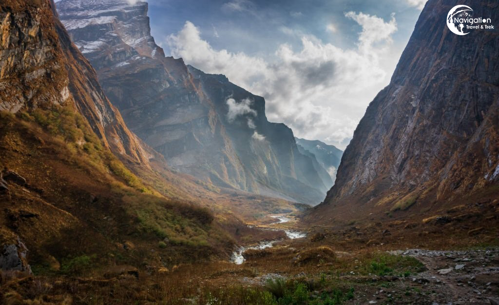
After seeing Muktinath Temple in the morning, we will continue to Tatopani by taking a local bus. At the beginning of our trip, we will travel across the landscape in the same geographic and climatic region as Tibet before arriving at the impressive Kali Gandaki valley. We first go through the Tibetan-style villages of Jharkot and Khingar before arriving at Jomsom. We get wonderful views of both Dhaulagiri and Nilgiri Himalaya. Then we will take a ride from Jomsom to Tatopani, which is known for its natural hot springs and where we may unwind by fully submerging ourselves in them.
Tatopani
Lodge
Breakfast, Lunch, Dinner
3760m
1hr
After leaving Tatopani, we go to the east bank of the Kali Gandaki River and climb to Ghorepani. Our journey passes through verdant forests with rhododendron, birch and magnolia trees as well as terraced farmlands with mountains all around. We’ll spend the night at the magnificent village of Ghorepani, which is situated on a ridge.
- Hiking time: 6-7 hours
- Trek Distance: 17km / 10.5miles
- altitude: 2860m / 9385 ft
- Accommodation: Teahouse/Lodge
- Meals included: Breakfast, Lunch and Dinner
Kali Gandaki River
Lodge
Breakfast, Lunch, Dinner
2860m
7hr
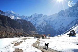
Our hike will come to an end on this day. For a spectacular sight of the entire Annapurna and Dhaulagiri massif, including Mt. Machhapuchhre, we walk early in the morning to Poon Hill (3,210m). The spectacular panoramas make Poon Hill one of the most popular locations for shooting as well as photography.
After photographing as many photos as we like, we’ll head back to our lodge for breakfast. We will hike to Birethanti and then board a bus to Pokhara after breakfast.
Birethanti
Lodge
Breakfast, Lunch, Dinner
3209m
1hr
Altitude Graph
Inclusion/Exclusion
The Cost Includes
- Three meals a day during the Trekking (Breakfast, Lunch and Dinner)
- Accommodations in Tea House during the Trekking.
- Drop to trek destination from Pokhara
- Trekking Guide, assistant trekking guide for groups with 12 or more trekkers and a porter (Sharing by two clients) with Insurance, food, and accommodations.
- Proper First aid kit
- Trekking permit (Annapurna Conservation Area Permit fee)
- A TIMS card (Trekking Information Management System) is like a permit.
- All government, local taxes, and official expenses.
- The company’s duffel bag will also be provided. (If needed)
- All essential official fees.
Service not included in the Price
- International Airfare
- Your travel insurance
- Nepal visa fee
- Any kind of drinks during the trek
- Other items of personal expenses like hot shower, battery charge, telephone, porter, and many more
- Tips for the Guide and Porter(expected).
Useful Info
ADDITIONAL INFORMATION
When trekking on the Annapurna Circuit Trek, the weather is the most critical aspect. Spring and autumn are perfect for trekking in this area. You can enjoy breathtaking views of the Himalayan range since there is no rain and the sky is clear from dawn to dusk. The monsoon season brings a lot of rain, while the winters are chilly with snowfall in the trekking regions. Trekking during these seasons is indeed difficult but not impossible.
Send Request
You can send your enquiry via the form below.
Trip name: * ANNAPURNA CIRCUIT TREK [5416 meters]


